
Location
Metrosquare Bldg, 224 Ortigas Ave, San Juan, 1503 Metro Manila


Dialogues 02
June 6, 2026
Creating Effective Maps for Good

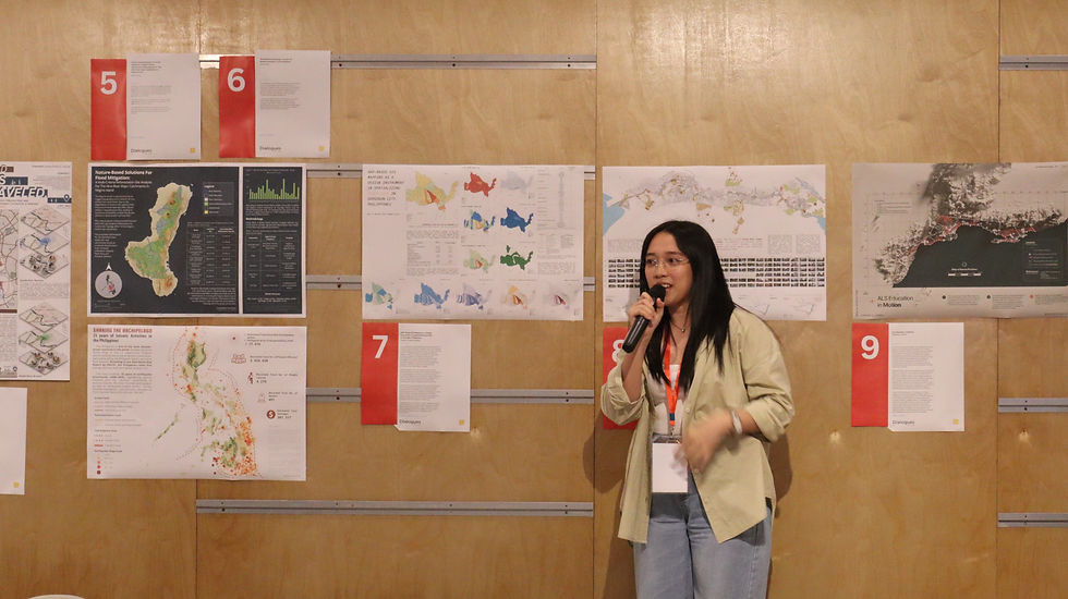
The Dialogues 02 panel finally commencing the insightful Q&A portion of the event. June 6, 2026. WTA Labs.
Our talk with the theme Creating Effective Maps for Good offered thoughtful and insightful discussions on the power of cartography, open data, and spatial tools in driving community resilience and urban transformation. We explored how maps act as interactive public-interest information systems, how citizen science can empower resilient communities, and how open-data mapping can be used to better understand our local schools, parks, and wetlands.
Conversations like these remind us that maps are not just static tools—they are dynamic platforms that strengthen public awareness, foster collaboration, and shape a more inclusive and sustainable future.
While the keynote presentations gave us incredible insights into data and cartography, the true highlight of the afternoon was the vibrant community that filled the room. From the engaging open forum to the lively conversations surrounding our Map Exhibit, it was inspiring to see professionals, advocates, and enthusiasts coming together to discuss how we can map a better future. An event like this wouldn't be possible without our incredible audience who brought thoughtful questions and curious energy to the floor.

Introducing GeoCite
During Dialogues 02, GeoCite was announced.
GeoCite is our means to extend our ways of communicating our map-based research in more interactive and imaginative ways. This is also our way of advancing our advocacy of improving science communication in the country, towards building a platform for research.
Science communication must be well-intentioned, towards better collective understanding of our spaces and environments.
Samuel Evangelista, our resident Ecologist, presenting and introducnig GeoCite and his experiences developing webmaps.

Navigate Dialogues 02 Map Exhibit

Click/Tap image to view
Click/Tap image to view
Exhibit
03
AHP-Based GIS Mapping as a Design Instrument in Spatializing Flood Risk in Sorsogon, Philippines
Exhibit by
Angelina Isabel Destajo
Abstract
This cartographic study examined the spatial dimensions of typhoon-induced flooding in Sorsogon Province, Philippines, a coastal region situated within the country’s major typhoon corridor. Developed as part of a broader architectural research project for Architectural Design 10 at National University, College of Architecture, Planning, and Sustainable Built Environment (NU-CAPSBE), the maps translated environmental hazard, exposure, and social vulnerability data into a composite flood risk assessment framework intended to support climate-responsive architectural and urban design strategies.
Using Geographic Information Systems (GIS) and the Analytical Hierarchy Process (AHP), multiple criteria derived from spatial datasets, community accounts, and expert inputs were weighted and synthesized into layered flood risk indices. These indices were subsequently integrated into composite maps identifying zones of concentrated vulnerability across low-lying coastal and urban areas.
Rather than functioning solely as technical representations of risk, the maps were conceived as interpretive design instruments that revealed the socio-spatial conditions shaping flood exposure and resilience. The mapping process emphasized the relationship between environmental systems, patterns of urban development, and community capacity, enabling spatial risk to inform architectural thinking at both the building and urban scale.
Produced within the context of climate adaptation research in the Philippines, the work proposed mapping as an active design methodology capable of informing flood-resilient planning, adaptive land-use strategies, and site-sensitive architectural interventions in vulnerable coastal environments.
- 7Page 3


Join our Map Exhibit!
We are featuring a map exhibit, as part of this June's Anthology Dialogues.
Click images below for instructions:


